/
Ziyuan-3 04
Launch Success
Liftoff Time (GMT)
03:17:00
Tuesday December 16, 2025
Mission Details
Read Article
Track Payloads
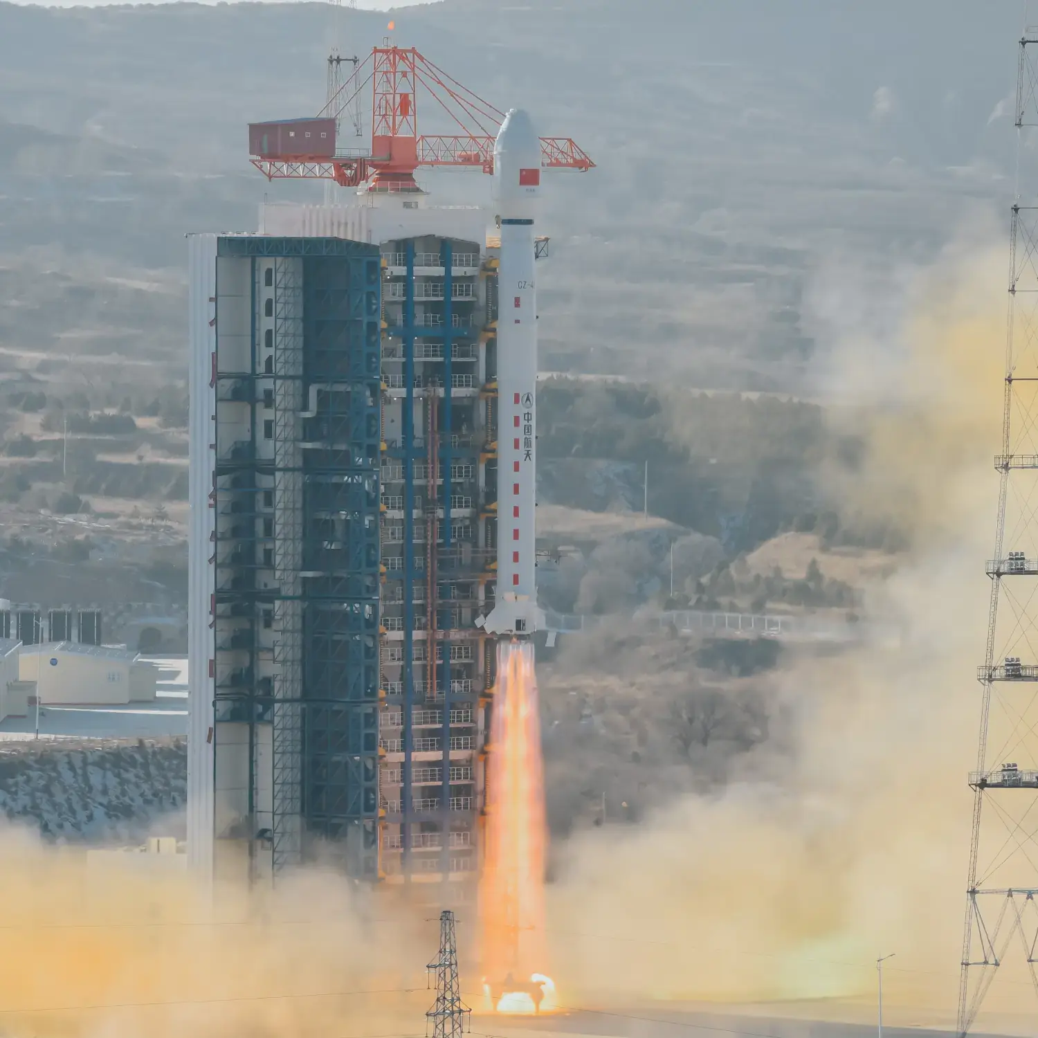
Ziyuan-3 04
The ZY-3 (Ziyuan-3, 'Resource-3') series represents China's first high-resolution, stereoscopic mapping satellites for civilian use. The second satellite is managed by the Satellite Surveying and Mapping Application Center (SASMAC). The imaging payload consists of a three-line camera array and a multispectral imager. The three-line panchromatic camera array to acquire stereoscopic imagery consists of three telescopic cameras with one oriented to the nadir and the other two each offset by 22° forward and backward in flight direction. The stereo mapping camera of ZY-3 has a resolution of 2.1 m for the nadir camera, and 2.6 m for the offset cameras. The swath width is 51 km. The multispectral imager for environmental and vegetation monitoring consists of a three-mirror telescope and a cooled detector system sensitive to four wavelength bands to capture full-color imagery as well as near-infrared data. The ground resolution of this system is 5.8 m.
Sun-Synchronous Orbit
1 Payload
2,630 kilograms
Rocket

Agency
CASCPrice
$64.68 million
Rocket
Height: 46.97m
Payload to Orbit
LEO: 4,200 kg
GTO: 1,500 kg
Liftoff Thrust
2,993 Kilonewtons
Fairing
Diameter: 3.8m
Height: 11.74m
Stages
3
Launch Site

SE
SW
Launching
South
Stats
Long March 4B
55th
Mission
3rd
Mission of 2025
2025
306th
Orbital launch attempt